Malangavi Promontory, Perahora, The Ruins of the Sanctuary of Hera
After 20 minutes of easy driving from Loutraki towads the promontory of Malangavi, past Vouliagmeni Lake and around a tiny cove at the furthest point of the Perachora peninsula, there is the shrine of Hera Acraea. This itinerary, through the serene and everchanging Perachora countryside, is a magnificent excursion, and would be strongly recommended even if the archaeological site never existed! This location is also known today as Cape Melangavi but also has gone by the name of Peiraion, Peraia, Heraion, Ireon (or even Hereon or Iraeon, with or without the final n), Akraea, and Akraia. The sanctuary was probably a possession of Megara in its earliest days but, later, it came under the control of Corinth. The archaeological site here seems divided into two separate sections, an appearance which, combined with various sources referring to the Sanctuary under two different names, Hera Limenia (of the port) and Hera Acraea (of the promontory) misled scientists to believe that there were actually two sanctuaries. It is here, according to the myth, that Medea, leaving Corinth, buried her two children she had slaughtered while fleeing her father's fleet, following Jason and the Argonauts.
The archaeological site roughly covers an area of 245 m (735 ft) by 45 m (135 ft); As shown in out photos, it embraces a small cove and goes uphill on a ridge. Please enjoy!
(Photos: Michael Tziotis)
Select Page of the Album:
Click on any of the pictures to enlarge.
On our way to there!

Vouliagmeni Lake, Malangavi: Panoramic Photo of the area |
|
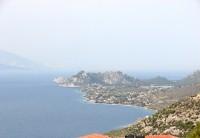
View of Malangavi promontory from the terrace of a café on the main road to Perachora
Vouliagmeni Lake is also visible |
|
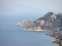
Same View of Malangavi using a telephoto lens
The Malangavi Light-House is also visible; we are to visit it later on! |
|
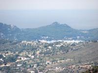
View of Lake Vouliagmeni from the same spot |
|
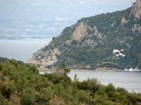
The Malangavi promontory with part of Vouliagmeni Lake
The small cove is just in front of the lighthouse, not yet visible |
|
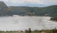
Malangavi Promontory area: Lake Vouliagmeni |
|

Panoramic View Malangavi Promontory |
|
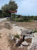
Malangavi Promontory, Perachora, Ancient Fountain
A couple of miles before getting there, we come across this sign. This used to be an ancient holy fountain! |
|
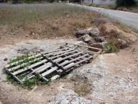
Malangavi Promontory, Perachora, Ancient Fountain
There is risk that somebody be hurt, so the fountain is covered in this disrespectful way! |
|
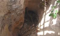
Malangavi Promontory, Perachora, Ancient Fountain
Putting the camera through the wooden frame, this is what remains from the fountain. |
|
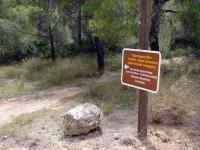
Malangavi Promontory, Perachora: Sign showing part of the Ancient road from Corinth-Therme (Loutraki)- Peiraeon (Perachora) to Heraion
This boulder was only part of the retaining wall for the road; the part of the road referred to in the sign is shown in the next photo. |
|
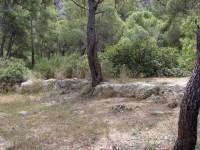
Malangavi Promontory, Perachora: Part of the Ancient road from Corinth-Therme (Loutraki)- Peiraeon (Perachora) to Heraion |
|
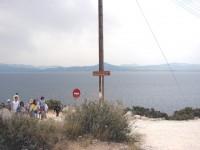
Malangavi Promontory, Perachora: End of the road, entrance to the archaeological site
There is a dirt parking place with just enough turn around space for the visitors' cars. Entrance to the site is free. |
|
|
Select Page of the Album:
|
|


